Notice: Undefined offset: 8192 in /var/www/vhosts/111/138386/webspace/httpdocs/handofhistory.com/photos/include/debugger.inc.php on line 112 Hand of History - Most viewed/Turoe Oppidum Inner-ward Outline Map

Hand of History

Burden of Pseudo History


Home Login
Album list Last uploads Last comments Most viewed Top rated My Favorites Search
Home > Image Gallery
Click to view full size image
Turoe Oppidum Inner-ward Outline Map
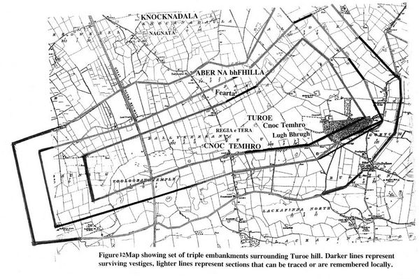
A set of 3 parallel embankments encircled Turoe Hill's extensive summit. Dark lines represent sur-viving vestiges, lighter lines represent trace-able sections or those remembered by elders. Knocknadalla Hill was similarly circumvallated. Together the 2 hills formed one oppidum core.
2_460_0___30_0_0_0_0_0_knockdalavn6.jpg new22.jpg 009.jpg River_IMG_0635.JPG End_IMG_0622.JPG